As suggested by the term Kluft, meaning “narrow gorge” in German or Dutch, the Naukluft comprises a myriad of narrow ravines in the massif. The most prominent feature in this mountain range is the Tsondab Gorge, which runs from north to south for 40 km. This gorge was carved by the ephemeral Tsondab River more than 300 million years ago, and can be traversed by car.
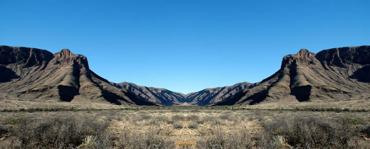
The Naukluft massif, which is one of Namibia’s distinctive geological features, forms a very prominent part of the escarpment. The mountain lies at the edge of the Namib Desert, 16º E and 24º S, just south of the Tropic of Capricorn.
The massif has an elliptical shape and constitutes a nappe complex of predominantly deeply incised limestone and dolomite rocks. It forms a plateau, which lies on the surrounding steppe like a flat slab with steep sidewalls. The Naukluft Mountains cover an area of around 2,100 km². They are 73 km in length, with a width of 27 km. No other mountain range in Namibia compares with the Naukluft’s morphological variety.
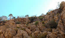
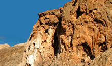
The actual mountain itself is made up of ancient pre-Cambrian rock, being up to a billion years in age. The nappe complex is predominantly comprised of carbonate rocks. Typical for these rocks are inherent high porosity and karst solution features.
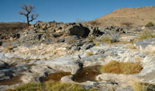
Through this dissolution, an extended porous network of underground pathways for the water has been formed. Any rain that falls on the plateau is absorbed into the rock and only reappears at the sides of the mountain range or in the gorges (Dunja Gaedecke & Judith Kaperski, 2004, Die natürlichen Grundwasser-austritte in der Naukluft und ihre Umgebung / “The natural groundwater seeps in the Naukluft and its surroundings”, Technical University, Braunschweig). This phenomenon can be observed easily during a walk through the Quiver Tree Gorge. The high water retention makes the Naukluft mountain plateau a natural water reservoir, which borders the desert. Even in drought periods these perennial springs are a boon to the area.
About 300 million years ago, during the permocarbon glaciation period, a great transverse gorge was carved through the Naukluft. The narrow gorge of the Tsondab River, which runs from BüllsPort via Blässkranz to Ababis, dissects the mountains into two massive parts. During the rainy season, this river channels large amounts of water from the more humid eastern portion to the arid parts in the west. The water eventually disappears into the red dune sands of the Tsondab Vlei. The topographic and geological mapping of the area dates back to 1935 when the German geologists Hermann Korn and Henno Martin, spurred on by their mentors Heinrich Lotz and Hans Cloos, started a survey of the area. The mountain fauna are diverse and species-rich, and can easily be observed at the multitude of springs. Birdlife in the Naukluft is particularly spectacular.